Julia Gearhart, Director of the Visual Resources Collection of the Department of Art and Archaeology at Princeton University, kindly spoke with Sara Brumfield about their experience using FromThePage.
First, tell us about your documents.
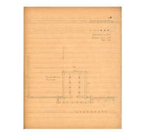
Our first project involved correcting OCR from typed excavation reports from the 1930s, of excavations of Antioch-on-the-Orontes. We now have a new project based around the notebooks and drawings from an earlier expedition, that of Howard Crosby Butler. Butler and a small team traveled throughout Syria in 1899, 1904, 1905, and 1909 surveying archaeological sites, with a particular interest in early Christian churches. We have a box of small pieces of paper, each page a sketch (with measurements) of a building feature related to a particular location. We also have about 25 notebooks from Butler and other members of the team, some diaries, and others notebooks with pages of surveying information. Around 1,200 photographs were taken on the expeditions as well.

What are your goals for the project?
The overarching goal of the project is to make all of the expedition’s historic documentation -- of these endangered or even destroyed archaeological sites -- openly available to the widest number of people.
This transcription project is one part of a two-part project, but both parts are currently in progress. First, we are attempting to geo-locate the historical places Butler visited with their modern locations, so that we can eventually create an interactive map of the journey. Second, we will connect each page within the archive -- whether a sketch of a building feature or a page from a diary -- to the location it describes.
We will have two main products: one will be an open dataset of the modern location, the archival location name, and all the image files and plain texts produced from the process. This will be available to platforms documenting cultural heritage in Syria, and to be translated into Arabic. Everything will have a CC0 Creative Commons license. The other product will be a kind of extended story map that will allow users to click on a location and bring up images and information for each location.
The images above are from one of Howard Crosby Butler's expedition diaries: "Butler Diary: Northern and Central Syria IV, 1900"
How are you recruiting or finding volunteers/collaborators?
Twitter! Friends! Family! Telling everyone we know.
Can you share your experience using FromThePage?
Both building a project and participating in a project with FromThePage is straightforward, which is such a relief for this kind of work. There is so much to think about in terms of sustainability that not having to learn a bunch of code or a complicated platform is a godsend. I had one student say it was “soothing,” to work on our project on FromThePage, and that made me so happy. I don’t want it to be tedious and boring work, because the subject is so interesting! FromThePage lets the subject be the focus, and makes it easy to work. I lose track of time a lot when I work on the project and don’t want to stop.
How does FromThePage & transcription/crowdsourcing fit with archeology?
There is really no funding for digitizing historic archaeological collections. For most people, archaeology is fieldwork but the reality is we have an enormous amount of understudied documentation that could yield meaningful findings, if people could just get to the stuff.
What would you tell folks considering a similar project?
Don’t be afraid to put everything out there, and don’t wait for perfection. Something is better than nothing. Think about how to make the raw data available to people at the end of the project too, and encourage people to play with it.
Check out the project page to read and transcribe these notebooks.


